A little inspiration for the road

Scenic drives near Aberystwyth

Discover the closest published Remapped drives to Aberystwyth, Wales. Routes are ordered by their nearest point to the town centre and may start elsewhere. Distances to routes are approximate straight-line distances, not driving distances. Roads featured include A487, A4159, A44.

Search another place or use my location ↗

29–173 milesRoute distances
54–285 minEstimated driving
4Circular routes

Short on time? Cambrian Uplands: Aberystwyth to Rhayader has the shortest estimated drive in this collection, at 54 minutes before stops.

8 drives to exploreAll collections →
Ceredigion and Powys, Wales

Cambrian Uplands: Aberystwyth to Rhayader

36 miles54 minPoint-to-point

Closest point on route: 0 miles from Aberystwyth · straight-line distance

Head inland from Aberystwyth through Ponterwyd and the Cambrian uplands towards Llangurig, then turn south to Rhayader. This is a broad mountain-country crossing using public main roads rather than reservoir access lanes.

Along the way
  • Cambrian upland road
View drive
Pembrokeshire, Ceredigion and Gwynedd, Wales

The Coastal Way: St Davids to Aberdaron Road Trip

166 miles4 hr 45 minPoint-to-point

Closest point on route: 0 miles from Aberystwyth · straight-line distance

Follow the established Coastal Way corridor between St Davids and Aberdaron. This is a major west-Wales road trip linking coastal towns, estuaries and mountain backdrops; use several days if you want time for the places around the route.

Along the way
  • Cardigan Bay
  • Mawddach Estuary
  • Llyn Peninsula
View drive
Aberystwyth to Rhayader

The Spine of Wales - The Cambrian Mountains

29 miles1 hr 2 minPoint-to-point

Closest point on route: 1 miles from Aberystwyth · straight-line distance

From Aberystwyth’s seafront, head inland to Devil’s Bridge before climbing through Cwmystwyth into the wild Cambrian Mountains. This scenic drive winds through open moorland and dramatic valleys, passing the Elan Valley reservoirs before descending into Rhayader. Expect sweeping views, remote stretches and plenty of reasons to stop along the way.

Along the way
  • Devil’s Bridge
  • Cwmystwyth and the mountain crossing
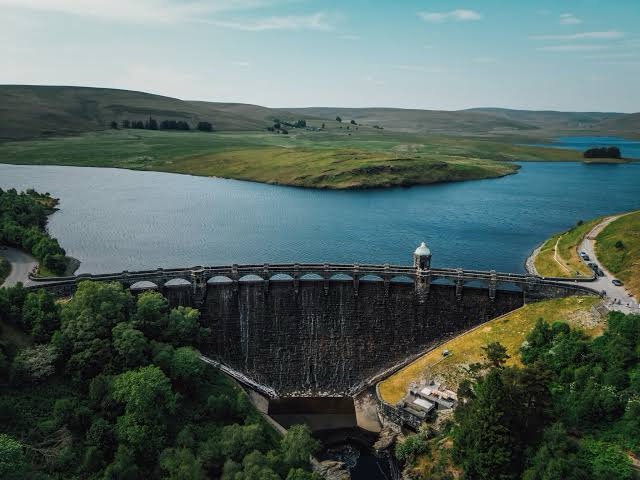
  • Elan Valley reservoirs
View drive
Powys and Ceredigion, Wales

Elan Valley Mountain Road and Devils Bridge Loop

42 miles1 hr 24 minCircular

Closest point on route: 10 miles from Aberystwyth · straight-line distance

Cross from the Elan Valley to Cwmystwyth on the mountain road, then continue along the B4574 towards Devil’s Bridge. Return by the A44 for a coherent upland circuit without reservoir visitor-centre or dam-access spurs.

Along the way
  • Elan Valley
  • Cwmystwyth
View drive
Gwynedd, Wales

Tal-y-llyn and the Dysynni Coast Loop

37 miles1 hr 3 minCircular

Closest point on route: 13 miles from Aberystwyth · straight-line distance

Cross the Tal-y-llyn side of the hills from Dolgellau towards Corris, then turn for Tywyn and return along the coastal corridor towards Fairbourne. Mountain slopes and lower coastal country make a varied longer circuit.

Along the way
  • Tal-y-llyn pass
  • Dysynni coast corridor
View drive
Powys and Ceredigion, Wales

Devils Staircase and Abergwesyn Pass Driving Loop

62 miles2 hr 28 minCircular

Closest point on route: 15 miles from Aberystwyth · straight-line distance

Climb the Devil’s Staircase on the Abergwesyn–Tregaron road, then return through the southern Cambrian countryside. This circuit gives the narrow mountain road room to stand out, rather than treating it as a quick shortcut.

Along the way
  • Abergwesyn Pass
  • Devils Staircase
View drive
Wales

The Cambrian Way: Cardiff to Llandudno Road Trip

173 miles4 hr 22 minPoint-to-point

Closest point on route: 20 miles from Aberystwyth · straight-line distance

Drive the A470 spine of the Cambrian Way from Cardiff’s northern edge through the heart of Wales to Llandudno. The journey changes from busier southern approaches to uplands, valleys and the northern mountain country.

Along the way
  • Bannau Brycheiniog
  • Cambrian Mountains
  • Eryri
View drive
Gwynedd, Wales

Snowdonia Coast, Crimea Pass and Bala Grand Loop

105 miles3 hr 1 minCircular

Closest point on route: 21 miles from Aberystwyth · straight-line distance

Link the Mawddach and Meirionnydd coast roads with the Ffestiniog uplands and the A4212 towards Bala. This southern Eryri circuit combines coast, reservoirs and mountain-country roads without duplicating the Llanberis pass loop.

Along the way
  • Mawddach Estuary
  • Crimea Pass
  • Llyn Celyn
View drive
Make a day of it.

Driving times exclude stops. Leave time for the views, check each route’s notes and make the journey your own.

Before you head out

Frequently asked questions

About the drives in this collection.

Which drive passes closest to this location?

Cambrian Uplands: Aberystwyth to Rhayader has the closest point on a route in this selection, approximately 0 miles from Aberystwyth in a straight line. This is not the distance to the route start or a driving-distance estimate.

Which is the shortest drive in this collection?

The Spine of Wales - The Cambrian Mountains is the shortest by route distance, at 29 miles, with an estimated driving time of 1 hr 2 min. Allow extra time for stops and the journey to the route.

Which is the longest drive in this collection?

The Cambrian Way: Cardiff to Llandudno Road Trip is the longest by route distance, at 173 miles. Its estimated driving time is 4 hr 22 min, excluding stops and travel to the route.

Are there circular drives in this collection?

4 routes start and finish in the same place, including Elan Valley Mountain Road and Devils Bridge Loop. Check the route map to find a convenient starting point.

Can I customise one of these drives?

Yes. Open a drive and choose Customise this route to edit a copy in the road trip planner. Sign in to customise; Premium is required to save your version. You can change stops or plan several days.